American Spring (aka Bear Spring)
Finally got an escape day to get out and try to find American Spring. It’s on the Taos side of the hike, about 4 miles from the El Nogal trailhead according to the maps.
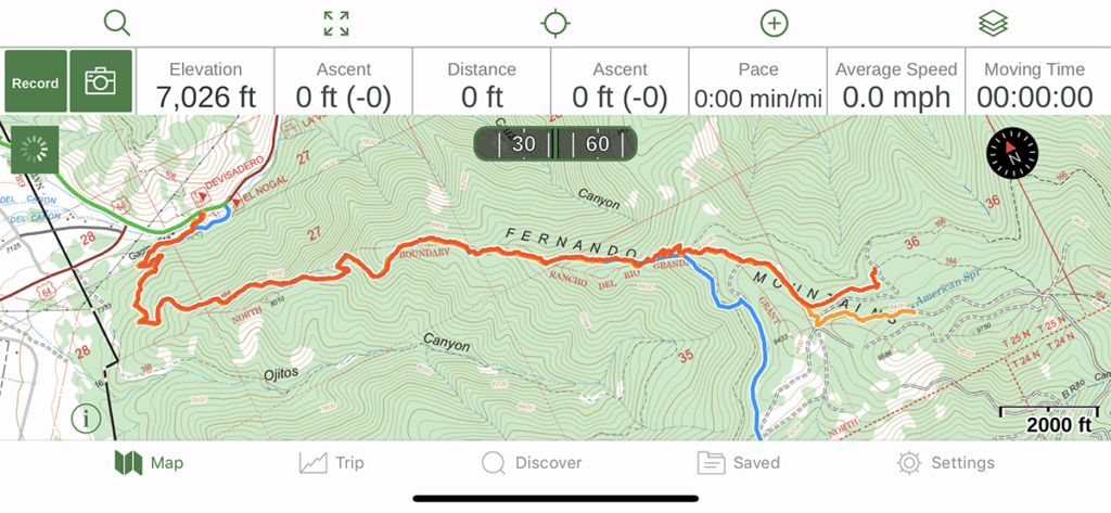
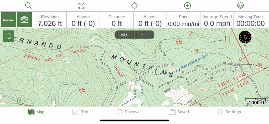
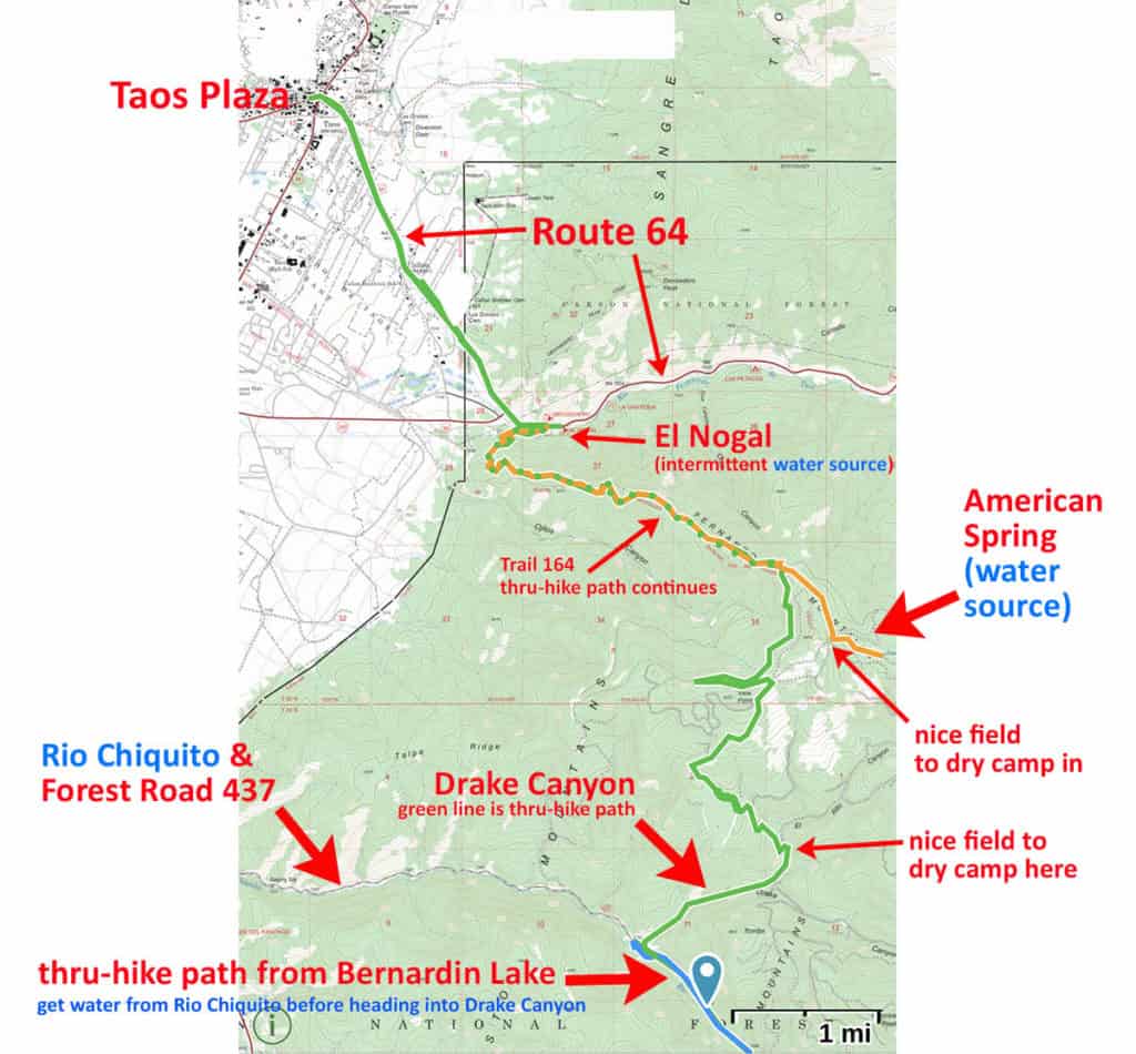
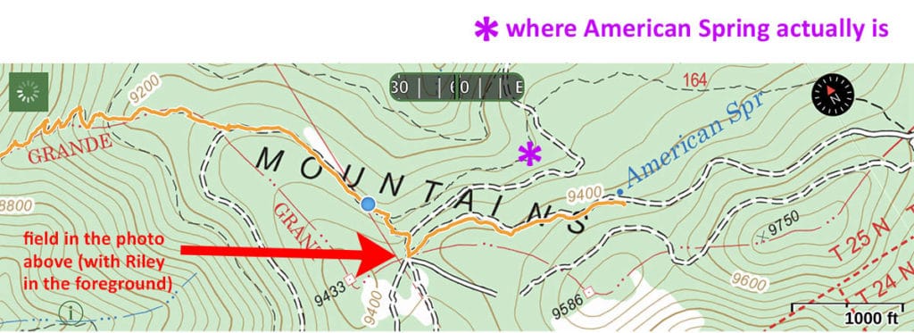
Where the maps (and Gaia GPS’s “USFS 2016” map) say American Spring is supposed to be is on the right side of the image above, right where the orange line terminates. The red line is our way back. Unfortunately the red line kinda covers the orange line in this screenshot. The blue line is where we came through for the thru-hike. The green line from El Nogal is where we continued on along Route 64 to head into Taos Plaza. I have since found a better way from El Nogal into Taos Plaza. Route 64 is nice, but the shoulder on that road is just too tight; it’s somewhat dangerous to walk along.
So that’s where we were headed. And this is what I learned:
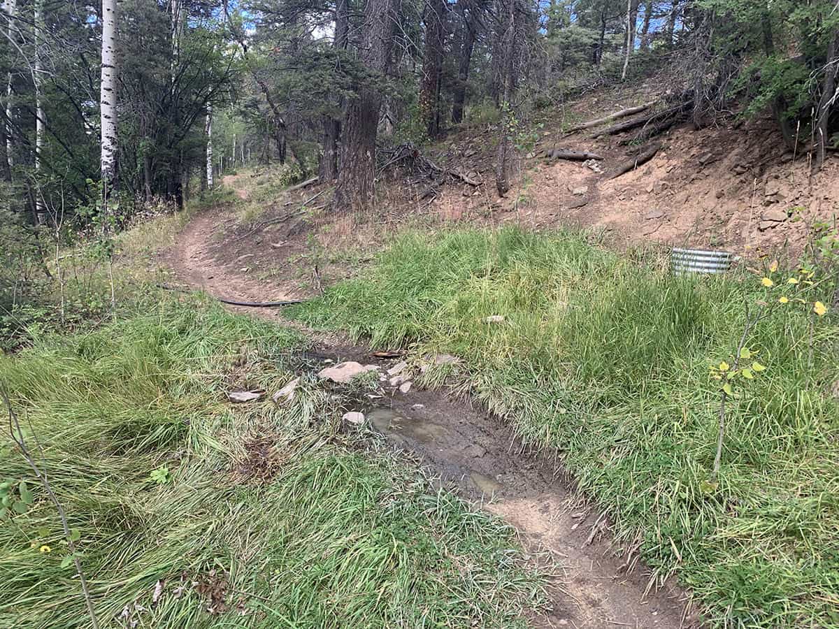
Thing I learned #1: The little stream at El Nogal sometimes actually runs. It wasn’t a crystal-clear mountain creek, but there was enough water for Riley to get a good drink and to cool his paws off when we got back. A human could drink out of this, too, but you’d need to treat it first.
Personally, I’d treat it twice. And maybe filter it, too (note to self: Is there a nalgene cap-style filter that would make water like this taste better than a stale mud puddle? Answer: Yes, there is.)
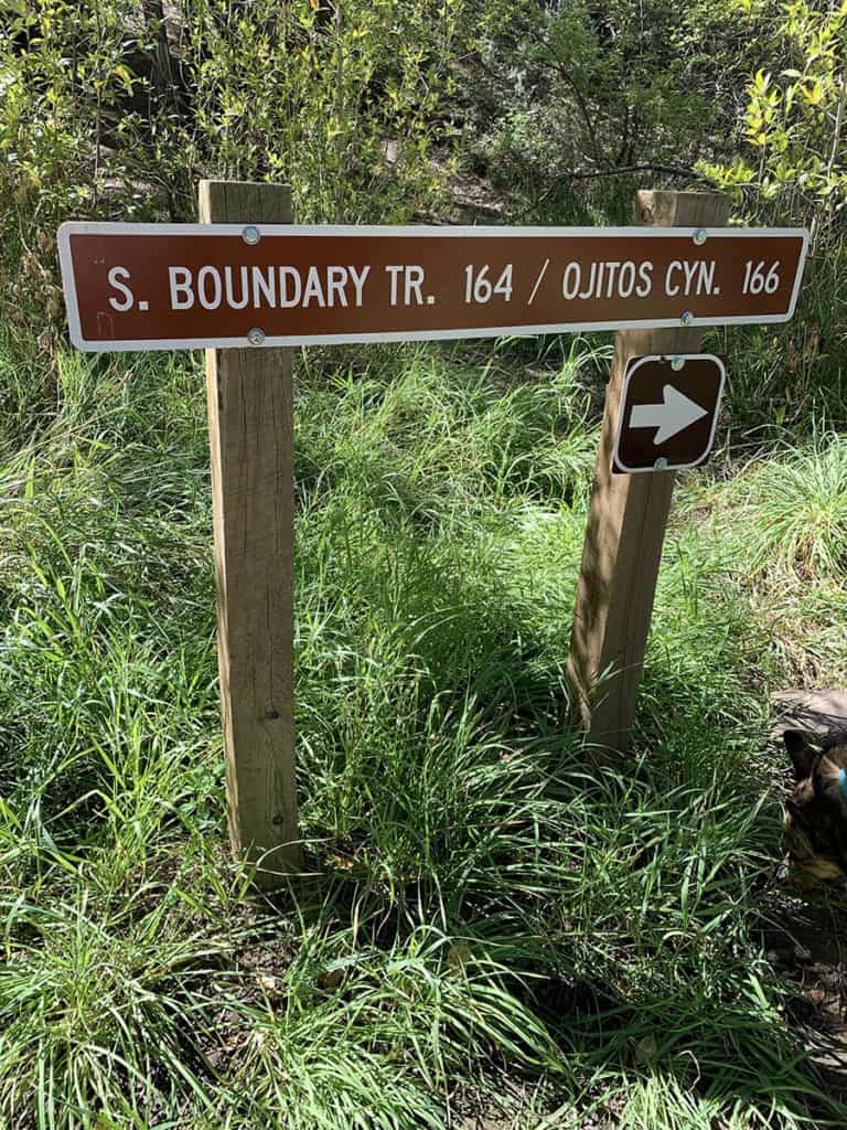
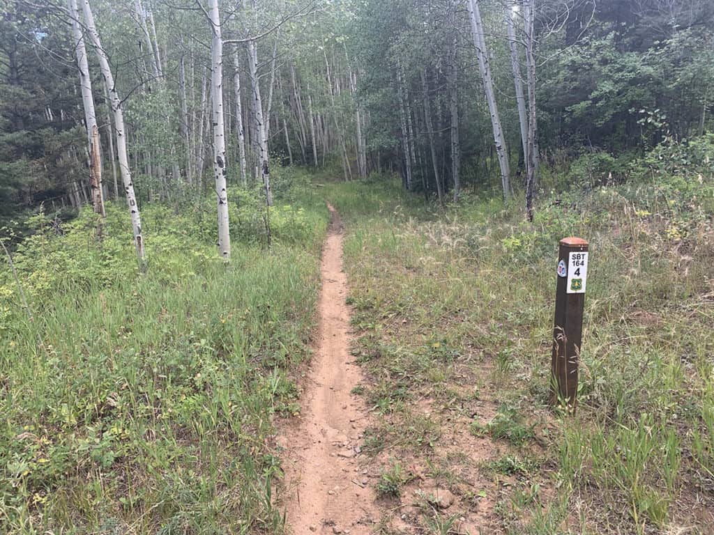
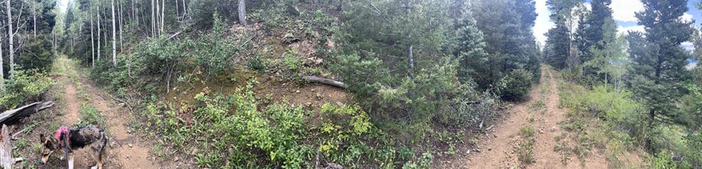
We headed up Trail 164. This starts fairly mellow (shaded, good footing, not too steep), then gets steeper and less shaded and with worse footing. It had been hard coming down it when we were finishing the thru-hike (mostly because we were exhausted) but wasn’t easy this time, either. It’s about 2,100 feet of elevation in 4 miles. American Spring is at 9,400 feet elevation (or at least that’s where the maps said it is).
Riley seems to get especially tired on this trail, I think because of the heat and the sun. He is not happy in the heat. Keep in mind we just did this on September 20th, and even yesterday, it felt dry and hot. In peak heat, it’s… well, bring electrolytes.
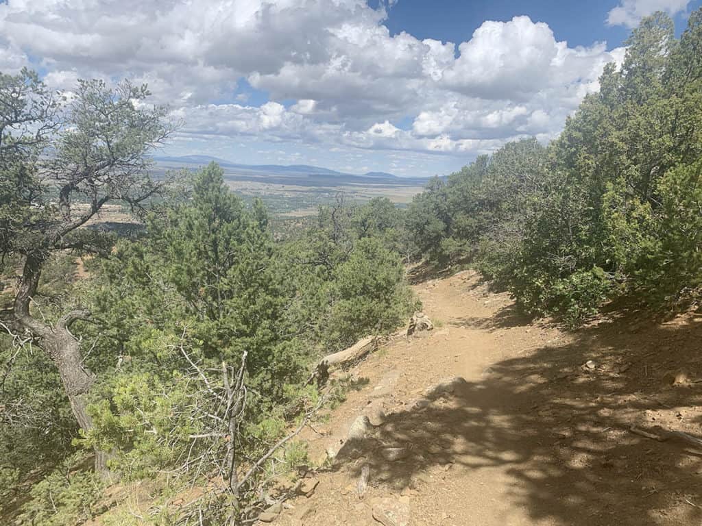
In defense of this trail, is it very well marked. There are mile markers at least for the first four miles, and probably further. And the views are terrific. Even 30 minutes up and you can get some nice sight-lines. All of Taos sweeps out to the west.
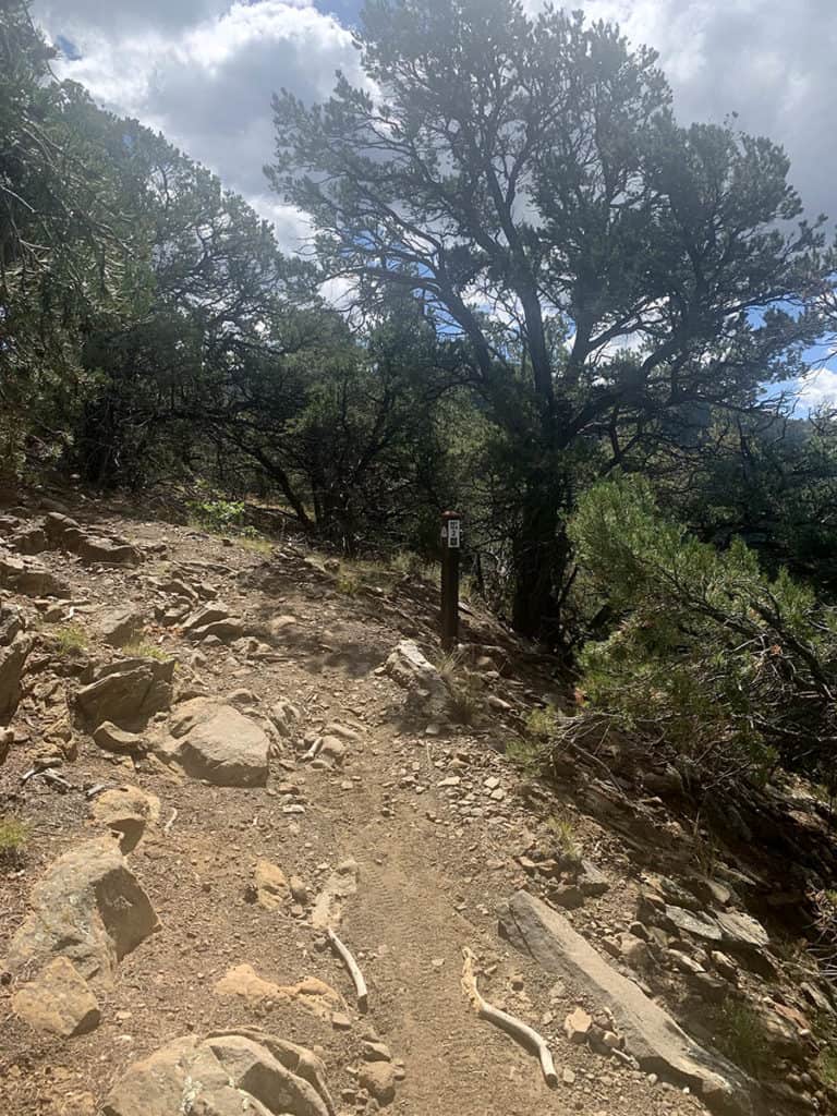
Eventually, you pass through the driest part of the trail and it levels out a bit. The dry juniper trees get mixed in with ponderosas, and the scrub oaks go from being knee height to shoulder height. The needles from the ponderosas make a mulch that supports more grasses, and that helps all the other plants thicken up into a better windscreen and lets them hold more water.
A bit into this area, and you’ll hit this intersection.
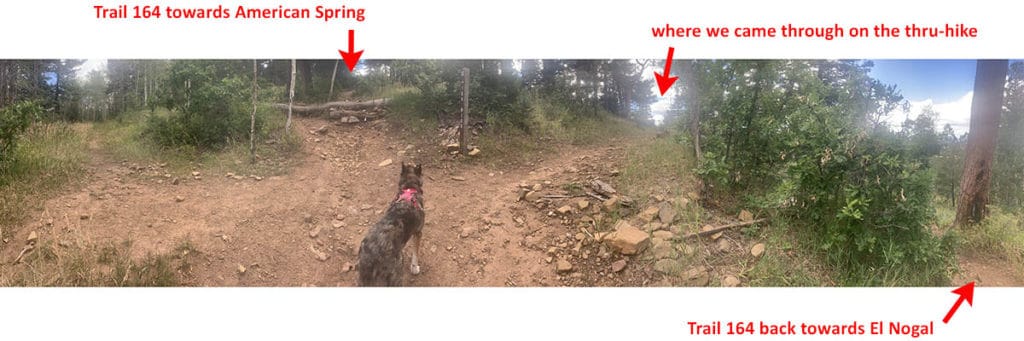
We went straight ahead to try to find American Spring.
In very few minutes (like 3-5) the vegetation shifts again. The clumps of grasses become solid fields and the aspens start. The clay ground was still holding a bit of water here and there.
To get to where American Spring was supposed to be, we were going to have to leave Trail 164 and go off on the Forest tracks. These are sometimes easy to see, and sometimes not so easy to see.
Here’s one that’s easy to see:
And one that’s not so easy to see:
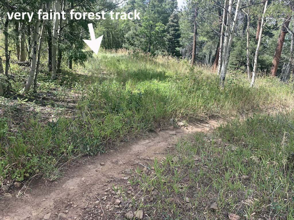
These tracks look the same on the maps. 164, which by far the most-used trail, looks very faint on the map.
On most maps, these forest tracks don’t even exist.
Why am I telling you this? Because I don’t want you to get lost, and I want you to know there are forest tracks, and they can be excellent, but the maps are unreliable. Sometimes there is no track where the map says there will be a track. Sometimes there is a track, but it’s so old and unused that the forest has grown up through it again. The track can be blocked with blowdown (fallen trees), or thickly overgrown with trees old enough to have trunks 3-6 inches in diameter.
The vagaries of forest tracks make this all a little bit more interesting. And because I’ve navigated them before, I knew if was highly possible that American Spring would not be where the map said it was.
And it wasn’t.
This is what we were looking at when we were right where the GPS map said American Spring would be.
No spring. Keep in mind that this is a pano photo, so it is distorted a bit. But you get the idea. Nice forest track, though, right? Some of them are in really good shape.
I walked about ten minutes further down this track just to be sure the spring wasn’t down further. No luck. But it seemed like there could be a spring around. The ground had enough moisture for it to be possible (this is New Mexico… we are sensitive about how dry the ground is. Anything better than “dry as dust” is promising.).
The land also sloped down. A lot. A nice good big v shape in the northish direction. Exactly the kind of land shape that would direct and focus a water flow. Might not result in a spring, much less a stream, but could produce a seep.
So we walked back, and I noticed another cruder track going off the to the right (East). We followed that down a bit. It had been dug up in these huge deep trenches, like 10 feet wide. Might have been to capture water in puddles. The digging was old – there was enough big vegetation that it was at least three or more years ago since someone dug the trenches.
We found an antler down on this part of the track. Riley was fascinated by it, sniffing and chewing. I left it behind because you’re supposed to. It belongs to the forest. Wanted to keep it, but I left it anyway.
We only had to walk about another 2-3 minutes and we came on to Trail 164. Took a left and headed back home. I figured, at the time, that was the end of American Spring. It wasn’t there. At least I tried.
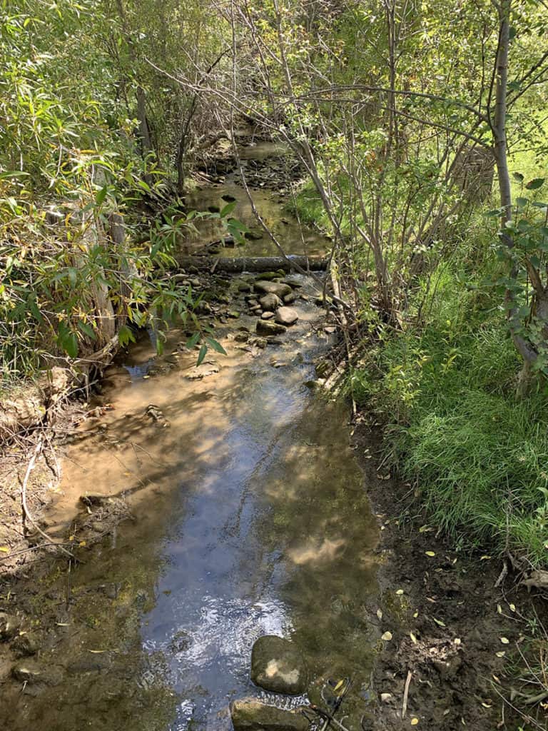
Until about four minutes later… we found it.
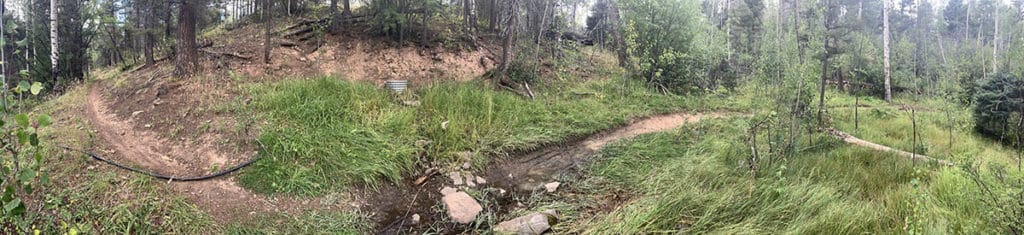
It is more of a seep than a spring, but it is there, right on Trail 164.
That silver tube is where you can get water.
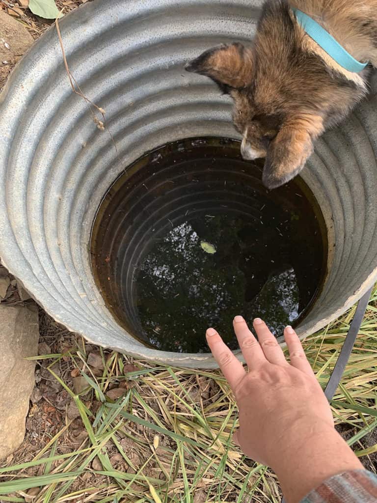
As you can see, it’s a reasonably large opening. As to water quality? It’s lacking. The water was clear enough to see about a foot below the water surface. It looked like there were a couple of questionable things down on the bottom. I will also try not to dwell on the possibility of some Fight Club-inspired jerk peeing in here. However, it is water. And there is no water for more than four miles in any direction. Closest would be El Nogal (which is not even reliable water, because that stream goes dry sometimes) or Rio Chiquito near Drake Canyon.
So if it was me… I would probably boil this water before I drank it. Or at the very least, treat it three times. But it is there. There is a water source on the ridge between Drake Canyon and El Nogal. That’s important for my little thru-hike.
Why Finding American Spring is Important to the Santa Fe to Taos Thru-Hike
When Riley and I did the thru-hike, we loaded up on water from Rio Chiquito at Drake Canyon, went up into Drake Canyon, over the ridge, and down 164 into El Nogal. There was no water at El Nogal, so we walked the rest of the way into Taos without water.
By grace, this super-nice sculptor was taking a break and standing outside his studio. He had several water bottles on hand and offered us two. We would have been very thirsty and dehydrated had he not been there. He even gave Riley a cut up hotdog. The full day from Drake Canyon to Taos Plaza was 11.5 miles. Definitely not terribly long, but after four prior hard days on the trail, it was long enough. Doing the last half of it dehydrated didn’t help. It’s something about the thru-hike I’ve wanted to fix for some time.
I left Rio Chiquito with maybe two nalgenes (two liters) plus a full 100oz water bladder. If I had been smart, I would have filled up my collapsible 2 liter container as well. With two extra liters (one for me, one for Riley) we would have been okay, even on the very hot way down on the steeper dry part of the trail. That would have been seven liters total for a big person and a dog. 15.4 pounds of water.
That’s not at all undoable, but 15.4 pounds is some weight. So finding this water source helps.
When I do the thru-hike again, I’m going to adjust the way I go so instead of taking that super-long green switchback, I’ll could take the right towards American Spring via either of the two forest tracks that go that way. I’ll hit 164, take a right, and then I’ll have to walk maybe a quarter of a mile to get to the spring. Then I can just head down 164 towards El Nogal. Going to the spring will add only about half a mile to the trek.
While the water from this spring is a little questionable, sometimes it’s really good to have an extra liter on hand. If you never need it, fine – dump it out when you get to better water.
This newly-found water source also gives people the option of stopping for the night. If you’ve pushed from Drake Canyon or beyond, or you got a late start from Taos Plaza, being able to get on the trail and geet a few miles in and have a nice flat, comfy place to camp for the night with a water source is a nice option. Having this water source provides that. If you don’t mind the mountain bikers going through, there are flat enough places along 164 within 5-10 mins walk of the spring.
Or you could use this field, which is about 5 mins off 164 via one of the forest tracks. I’ve marked it on the map below.
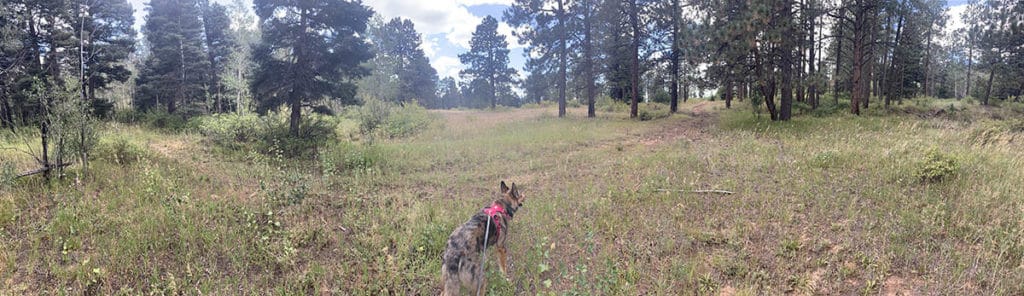
There is no fire pit that I saw here, but please – skip the fires in the woods, okay? To cook, use a safe stove and put a flexible metal protector under it to protect the ground. Do not burn these woods.
So that’s what I spent my getaway day on – finding a water source between Drake Canyon and El Nogal. It was a precious investment of time for me and took 12 hours round-trip, but it’s worth it. Just treat that water thoroughly, okay?
Enjoyed article/