Update about the May 2022 fires
As you probably know, the Hermit’s Peak / Calf Canyon fire is sweeping up the eastern flank of the mountains between Santa Fe to Taos. It may well reach all the way from Las Vegas to Angel Fire within a week. It shows no signs of stopping. There is no rain forecast for at least two weeks.
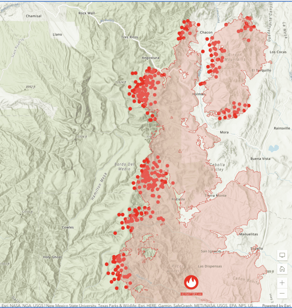
What began as a prescribed burn is now 288,942 acres and only 36% contained as of this morning, May 15th.
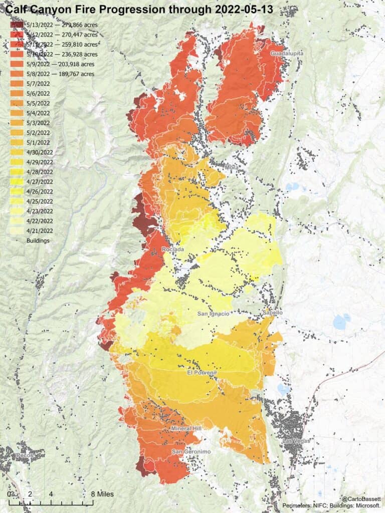
Here’s a satellite map with a heat spot and an active wildfires overlay from Arcgis this morning:
I’m conflicted about saying there’s any “good news” about this, as so many people have lost homes and ranches and spaces precious to them. Really, I’ve been struggling to say anything about this. A few times I’ve gone out to the Galisteo Basin Preserve at night, parked my car facing northeast, and just looked at the distant red glow on the horizon. Sometimes we can see a huge plume from behind near Santa Fe mountains (Baldy and the top of the ski basin).
It’s grim. There’s no way to sugarcoat it. The air is brutally dry. The trees ache. There are fires to both the east and west of us. And there is no rain in sight. Nothing. Accuweather had been forecasting some rain the last day of this month, but they’ve backed off on even that. The next time we’ll see rain, according to them, is July 30th.
And no, this is not normal. This is not even sort of normal. We are as dry as we’ve been in 1,200 years.
My job here – my little job – is to tell you how this is affecting the thruhike. The “good” news is that the fire has not yet burned through significant parts of the hike. It is perilously close to Angostura, and it is burning at Romero Lake.
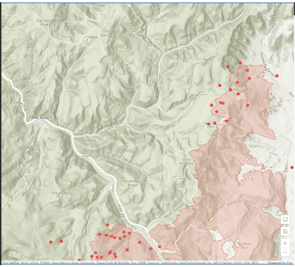
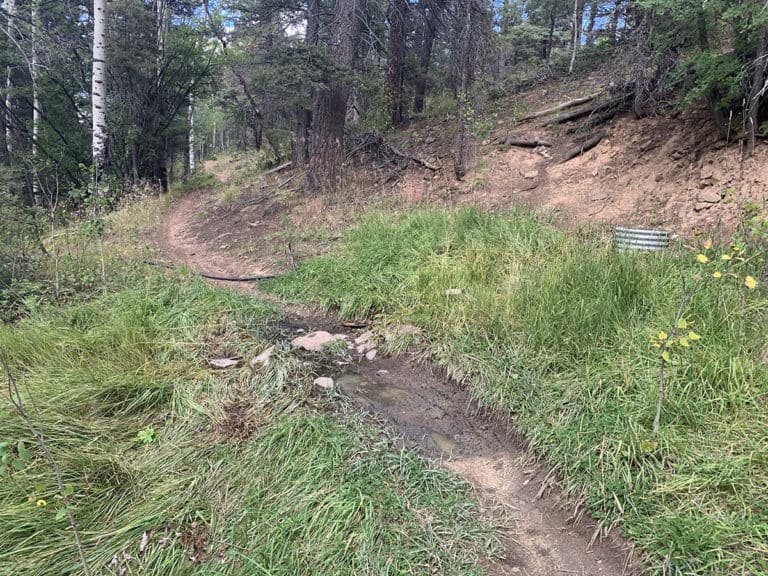
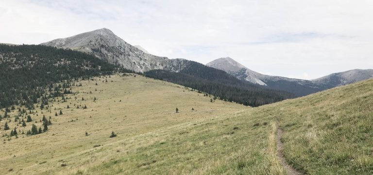
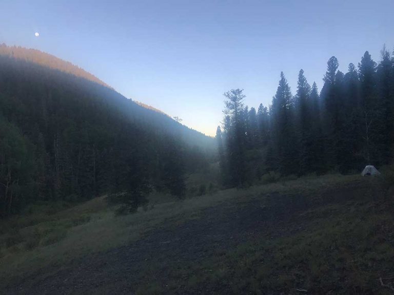
The way I went through this area is outlined in Day 7 – Los Estrellos to Agua Sarca Canyon and Day 8 – Agua Sarca Canyon to just north of Little Korea.
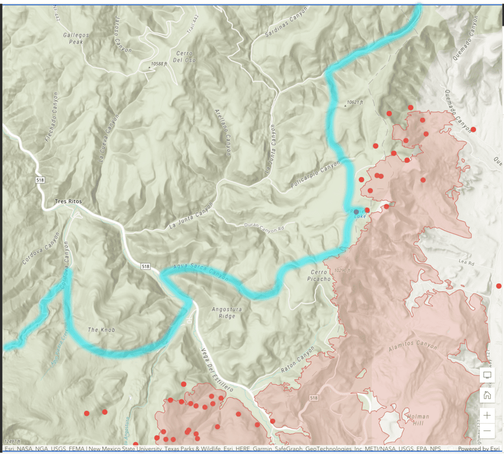
Here’s a rough overlay of the path I took on Days 7 and 8 with the fire information as of this morning, May 15th.
So.
So if I was doing this again (which I hope to do, but more on that later), I would have not taken that very hard right before the Knob (see the lower left-hand corner of the map). I would not have gone around the Knob, through Angostura, through Agua Sarca Canyon, or towards Romero Lake.
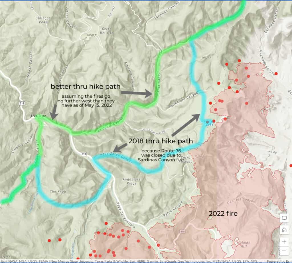
Instead I would have stayed straight in Cordova Canyon (the east branch of it, still in that lower left-hand corner of the map above). I would have come down through Tres Ritos and walked up Route 76 (also known as “La Junta Canyon, as it is marked on the map above) all the way to where I camped the 8th night of the thru hike.
So this is what the “better” route looks like now that Route 76 isn’t closed (assuming, of course, that this entire area doesn’t burn).
This is not the only section of the thru hike I am worried about (Make no mistake: Right now I am worried about every acre of the forest, in every direction).
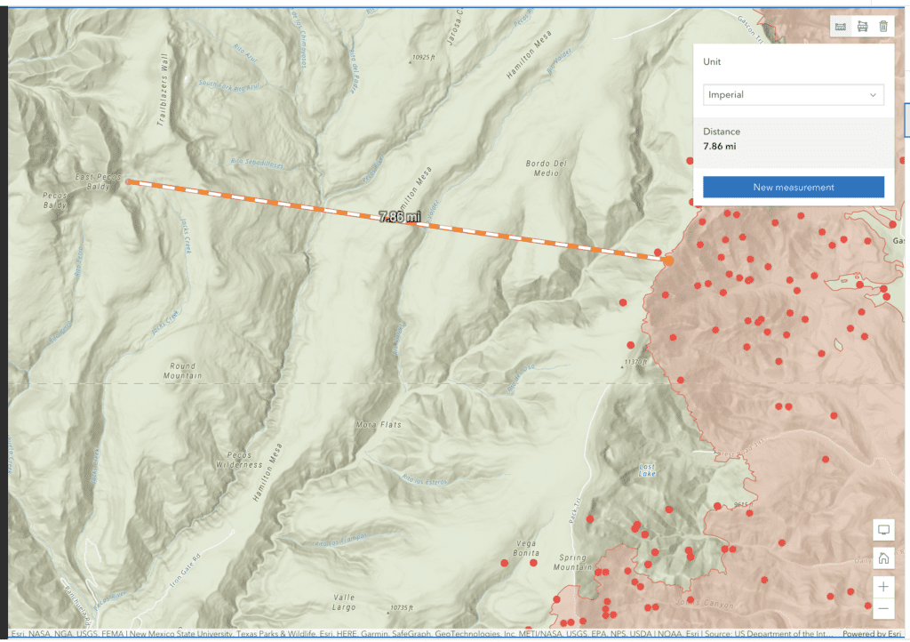
The fires are also quite close to Terrero, Cowles, and all the nearby sites. They are 7.86 miles from East Pecos Baldy lake as of this morning. That could seem like a safe distance, but remember that this fire has grown by 30,000 acres overnight on some nights.
And also, of course, consider all the places already lost.